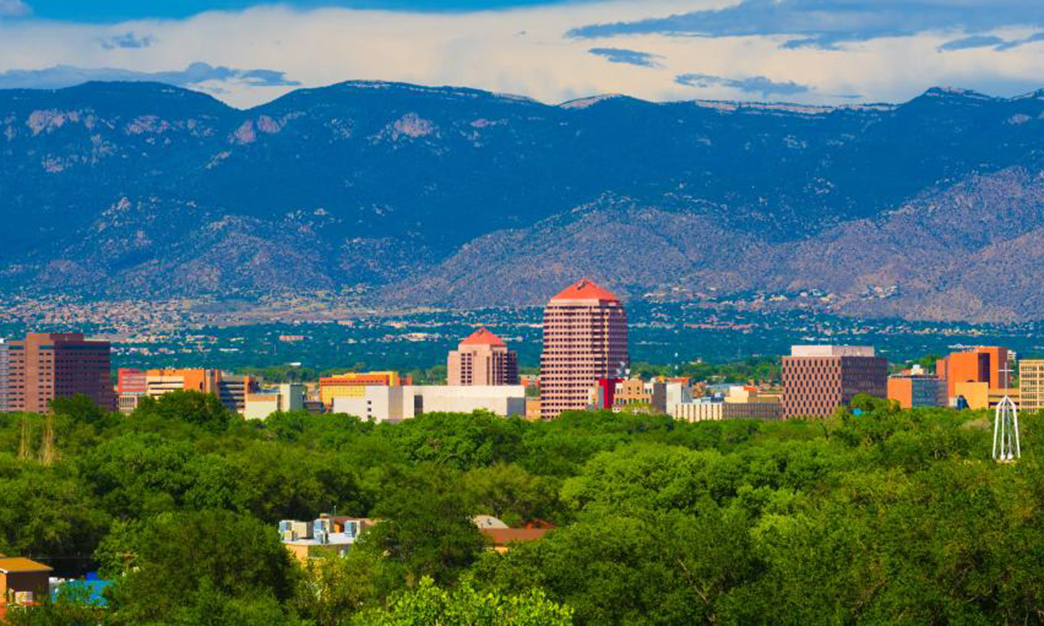
When people ask me what I love most about Albuquerque, my answer is never just the food, or the museums, or the sunsets. It’s the way this city blends urban life with open skies, desert mesas, and mountain trails. I can honestly say that Albuquerque has some of the most accessible outdoor adventures of any U.S. city.
You don’t have to drive hours to feel like you’re in the wild here—bike paths cut through the Rio Grande bosque, trails climb into the Sandia foothills, and even volcanoes sit just outside town.
On my last trip, I decided to spend as much time outdoors as possible. That meant hopping on a rental bike, lacing up my walking shoes, and hitting the trails. Below, I’ll share my three personal favorite biking and walking adventures in Albuquerque, followed by four more trails and areas I recommend if you’re looking to expand your itinerary.
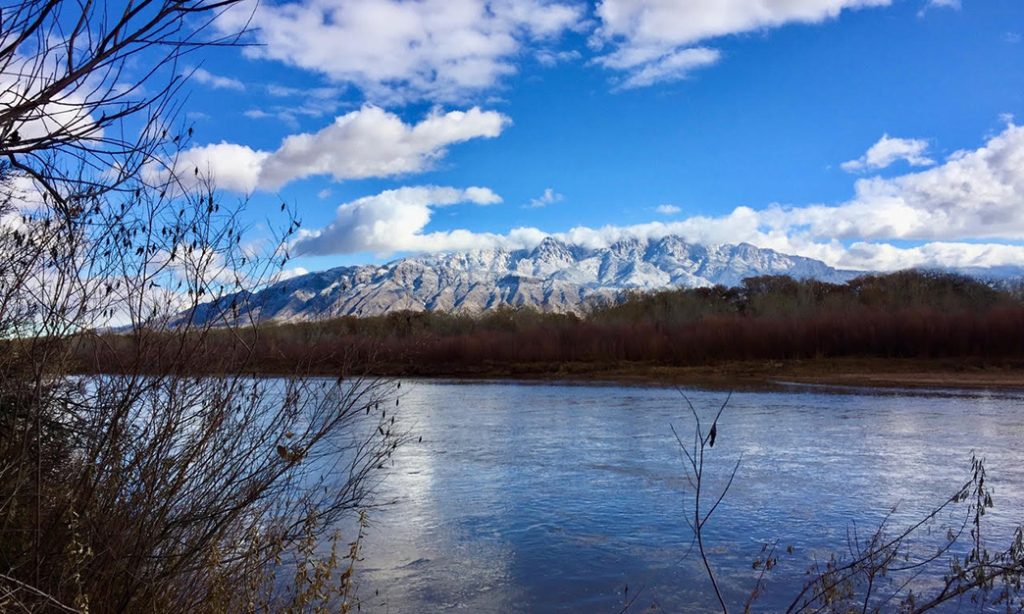
🚴♂️ My First Adventure: The Paseo del Bosque Trail
📍 Location: Runs along the Rio Grande, from Alameda Boulevard in the north to Rio Bravo Boulevard in the south
📏 Distance: 16 miles one way
🕘 Hours: Sunrise to sunset
🎟️ Fees: Free access
My Experience
I’ll start with the trail that made me fall in love with Albuquerque’s outdoors: the Paseo del Bosque Trail.
On a crisp morning, I rented a hybrid bike from Routes Bicycle Tours & Rentals (located at 2113 Charlevoix St NW). The staff gave me maps, a helmet, and even tips on where to stop for coffee along the way. Pedaling onto the trail, I immediately felt the difference from city streets—the cottonwood bosque hugged me in cool shade, and the Rio Grande shimmered to my left.
This trail is flat, smooth, and quiet, which made it perfect for a long, meditative ride. I passed joggers, birdwatchers, and families out for a stroll, but never felt crowded. My favorite part was stopping at the Rio Grande Nature Center State Park, where I locked my bike and took a short walk to a pond filled with ducks and turtles.
I ended up cycling nearly the full 16 miles, turning around near the South Valley. By the end, my legs were tired, but my heart was light.
Services & Facilities
• Water fountains and restrooms at key access points (e.g., Alameda Open Space, Rio Grande Nature Center).
• Benches and picnic areas.
• Several bike rental shops in Albuquerque.
Pros & Cons
• Pros: Flat and easy for all levels, shaded sections, wildlife viewing, safe and well-maintained.
• Cons: Limited lighting—avoid late evenings; some sandy spots near access points.
Getting There
From downtown Albuquerque, it’s just a 10-minute ride or drive to access points near the Nature Center or Central Avenue. Free parking available at many trailheads.
Activities I Recommend
• Stop for birdwatching at the Nature Center ($3 entry).
• Pack a picnic for one of the riverside tables.
• Bring binoculars—bald eagles and cranes can sometimes be spotted.
My Recommendation Index: ⭐⭐⭐⭐⭐ (5/5)
🥾 My Second Adventure: La Luz Trail in the Sandia Mountains
📍 Location: Cibola National Forest, Sandia foothills
📏 Distance: 7.5 miles one way, 3,200 feet elevation gain
🕘 Hours: Sunrise to sunset (trailhead gate closes at 8 PM)
🎟️ Fees: $3 parking fee at trailhead
My Experience
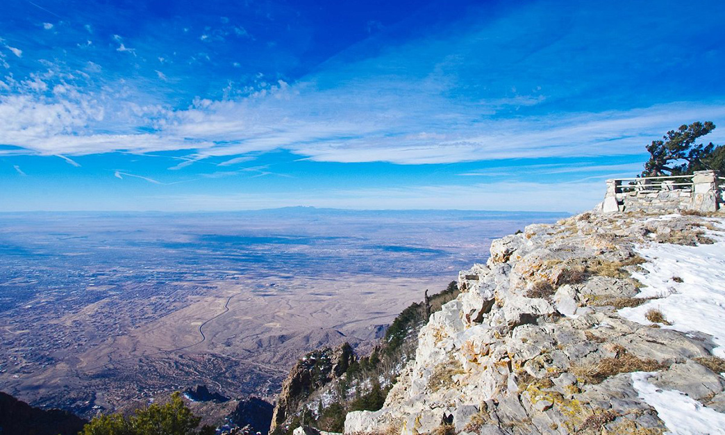
I’ll be honest: the La Luz Trail is not for the faint of heart. But it was also one of the most rewarding hikes I’ve done in New Mexico.
Starting from the base trailhead, the first mile lulled me into thinking this would be easy—gentle switchbacks, desert plants, views of Albuquerque below. But as the trail climbed, the air thinned, the rocks got rougher, and my calves burned. By mile five, I was questioning my sanity.
And then I reached the overlook at about 9,000 feet. Suddenly, all of Albuquerque stretched below me, framed by sheer cliffs and pine forests. It felt like standing on the edge of two worlds—desert to the west, alpine to the east. I didn’t make it all the way to the top (the trail ends at Sandia Peak, 10,678 feet), but I hiked far enough to know I’ll be back.
Services & Facilities
• Small parking lot with toilets at trailhead.
• Water is NOT available—bring at least 2 liters.
• Tramway near Sandia Peak offers rides down (check schedule before planning).
Pros & Cons
• Pros: Epic views, diverse ecosystems, bucket-list hike for serious hikers.
• Cons: Strenuous climb, can be very hot in summer, icy in winter.
Getting There
I drove about 25 minutes from downtown to the trailhead, located off Tramway Road NE. Parking was $3 (cash only).
Activities I Recommend
• Start early (before 8 AM) to avoid heat and crowds.
• If you don’t want to hike down, ride the Sandia Peak Tramway ($25 one-way).
• Bring trekking poles—they saved my knees on the descent.
My Recommendation Index: ⭐⭐⭐⭐½ (4.5/5)
🌋 My Third Adventure: Volcanoes Trail at Petroglyph National Monument
📍 Location: Western edge of Albuquerque, accessed via Atrisco Vista Blvd
📏 Distance: 4 miles of interconnected trails
🕘 Hours: Sunrise to sunset
🎟️ Fees: $1 weekdays, $2 weekends for parking
My Experience
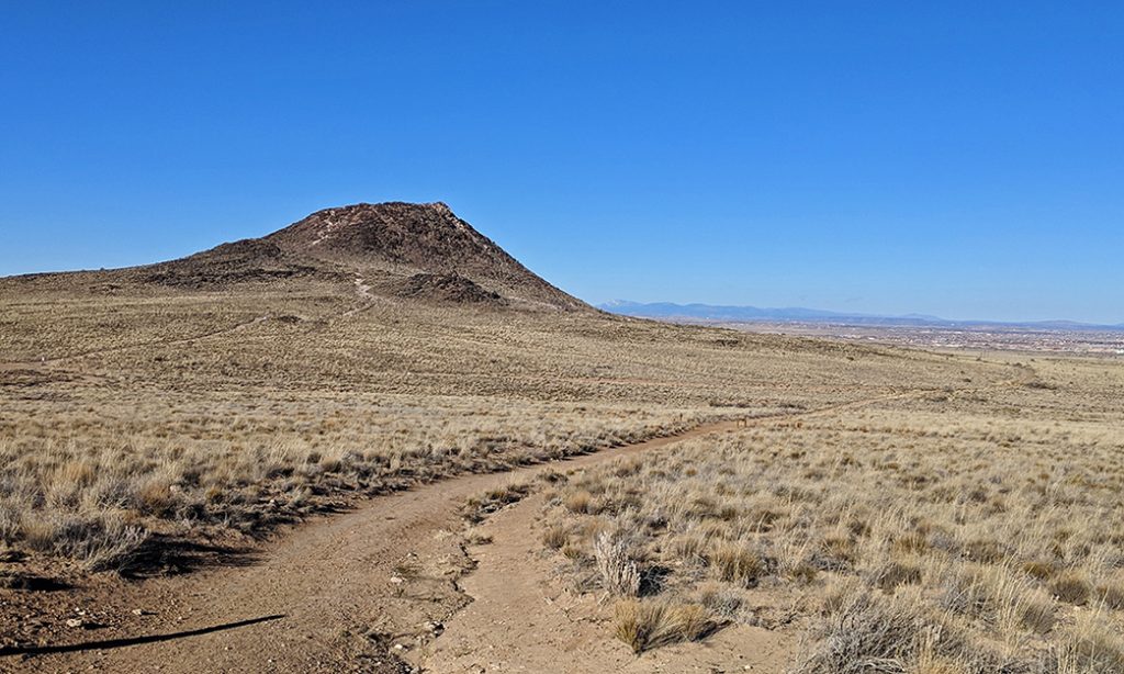
The Volcanoes Trail might not be as famous as the La Luz or Paseo del Bosque, but for me it was unforgettable.
Walking among three dormant volcano cones, I felt like I was on another planet. The black volcanic rock contrasted starkly with the desert scrub, and the silence was almost otherworldly. Along the way, interpretive signs explained how these cinder cones formed about 150,000 years ago.
What struck me most was the view—on one side, the volcanoes; on the other, the entire city of Albuquerque and the Sandias in the distance. I brought a thermos of coffee, sat on a rock, and just soaked it all in.
Services & Facilities
• Small parking lot with toilets.
• Simple dirt trails—no shade, so bring sun protection.
Pros & Cons
• Pros: Unique volcanic landscape, easy trails for families, close to the city.
• Cons: Exposed to sun and wind, no water available.
Getting There
A 25-minute drive west from downtown via I-40 to Atrisco Vista Blvd. Parking is cheap and plentiful.
Activities I Recommend
• Hike near sunset for dramatic colors.
• Bring a field guide—this is a great spot for geology lovers.
• Pair with a visit to the nearby Boca Negra petroglyphs.
My Recommendation Index: ⭐⭐⭐⭐ (4/5)
🚶 Four More Trails & Routes I Recommend
Even though I couldn’t personally cover them all on one trip, these four are highly recommended by locals and repeat visitors:
- Elena Gallegos Open Space
• Location: Northeast foothills of the Sandias
• Distance: 7 miles of interlinked trails
• Highlights: Views of the Sandias, picnic shelters, wildlife spotting
• Services: Restrooms, parking ($1 weekday, $2 weekend)
• Tip: Great for sunset picnics with the mountains glowing pink. - Foothills Trail System
• Location: East Albuquerque, along Tramway Blvd
• Distance: 50+ miles of trails across the foothills
• Highlights: Mix of easy to moderate hikes, perfect for morning jogs or quick rides
• Services: Multiple trailheads with free parking
• Tip: Perfect alternative if La Luz feels too strenuous. - Paseo del Norte Trail
• Location: Runs east-west across Albuquerque
• Distance: 8 miles
• Highlights: Urban biking and walking, connects neighborhoods with open views
• Services: Rest areas and bike lanes
• Tip: Great for commuters and casual cyclists alike. - Corrales Bosque Preserve
• Location: Village of Corrales, just north of Albuquerque
• Distance: Several miles of dirt paths along the Rio Grande
• Highlights: Peaceful forested paths, birdwatching, rural charm
• Services: Small parking lots; few facilities
• Tip: Perfect for a quiet morning walk away from the city bustle.
🚗 How to Get There: Transit & Driving Tips
• Albuquerque International Sunport: The main airport, just 15 minutes from downtown. Car rentals are available on-site.
• Driving: Most trails require a car to reach. Parking is cheap ($1–$3).
• Public Transit: Some ABQ Ride buses reach trailheads in the foothills, but schedules are limited—plan carefully.
• Bike Rentals: Shops like Routes Bicycle Tours and Sport Systems rent bikes from $30/day.
💻 Booking & Resources
• Recreation.gov: For Sandia National Forest trailheads and some federal lands.
• City of Albuquerque Open Space: For local trail maps and parking info.
• New Mexico State Parks: For Nature Center access.
• AllTrails App: My go-to for trail reviews and GPS maps (free and premium).
Why Albuquerque’s Trails Captured My Heart
When I travel, I always try to balance city exploration with outdoor escapes. In Albuquerque, that balance is effortless.
Cycling the Paseo del Bosque, I felt serenity I didn’t expect in a major city. Hiking the La Luz Trail, I pushed myself to new limits and earned jaw-dropping views. Walking the Volcanoes Trail, I felt like I had stepped into New Mexico’s deep geological past.
The other trails—Elena Gallegos, the Foothills, Paseo del Norte, and Corrales Bosque—show that there’s no shortage of variety here. Whether you’re a serious hiker, a casual cyclist, or just someone who wants a relaxing walk, Albuquerque delivers.
These aren’t just trails. They’re stories written in sand, stone, and sky. They’re the reason I’ll always come back, no matter how many other places I see.
So if you’re visiting Albuquerque, don’t just stick to Route 66 and Old Town. Bring your sneakers. Rent that bike. Hit the trail. You’ll leave with more than photos—you’ll carry the desert wind, the mountain silence, and the spirit of the Land of Enchantment with you.